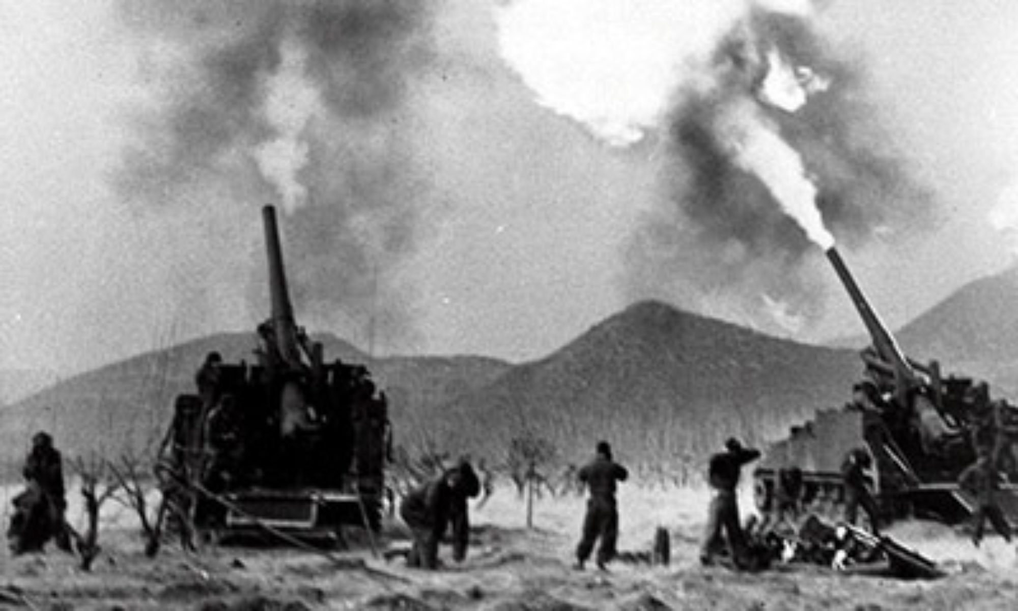
On January 22, 1981, the Paquisha War between Peru and Ecuador broke out when a Peruvian transport helicopter was fired upon in the Comaina Valley, in a Peruvian-controlled area that had been seized by Ecuadorian troops. Subsequently, Peruvian authorities discovered that the Ecuadorians had constructed three outposts in the Comaina Valley along the eastern slope of the Condor. The Ecuadorians named their outposts Mayaicu, Machinaza, and Paquisha, with the latter for which the coming war was named. In an Organization of American States (OAS) foreign ministers meeting held on February 2, 1981, the Peruvian representative denounced the Ecuadorian action. Then in the next few days, Peruvian forces attacked the outposts, forcing the Ecuadorians to withdraw to their side of the Condor Mountain Range. By February 5, Peru had regained control of the whole Comaina Valley and also seized Ecuadorian military supplies and equipment that had been abandoned.
(Taken from Paquisha War – Wars of the 20th Century – Volume 2)
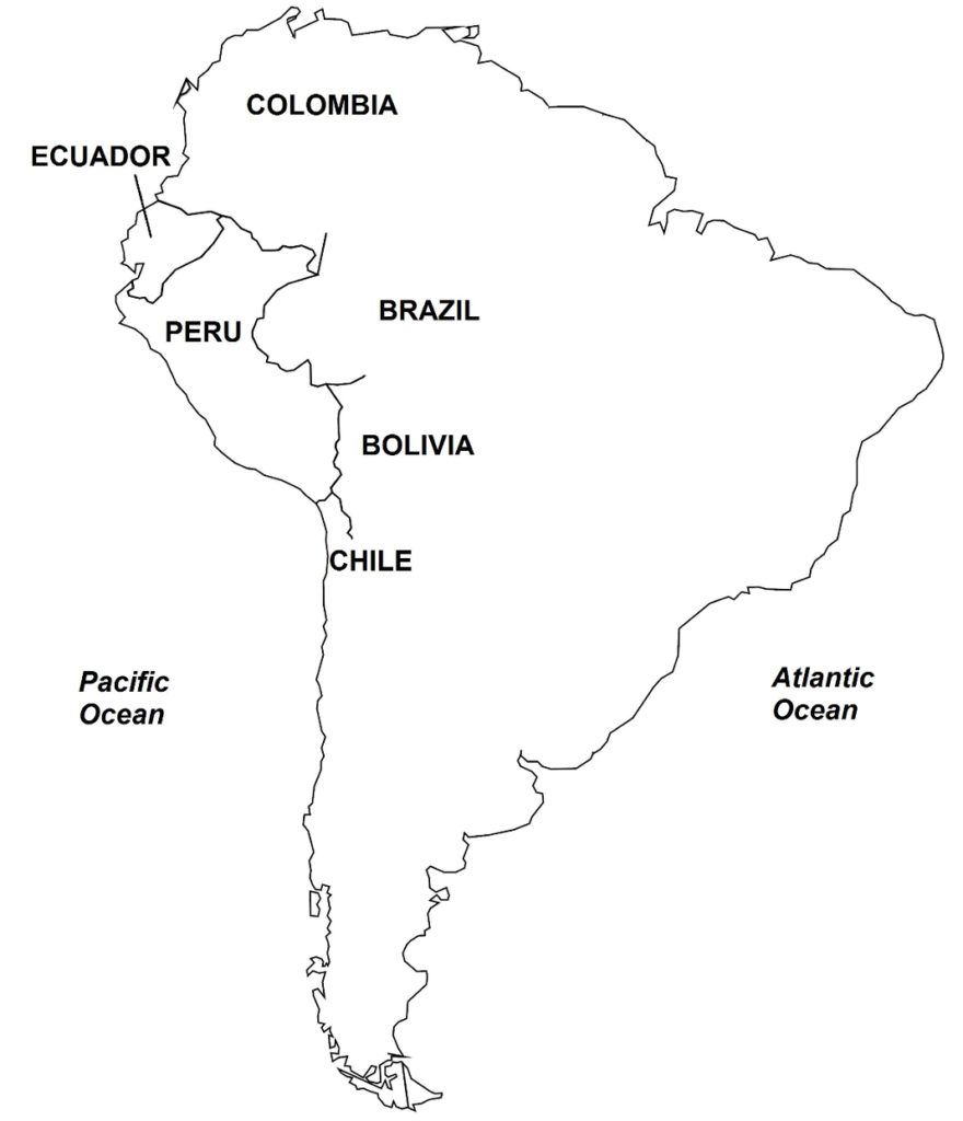
Background In July 1941, Ecuador and Peru (Map 38) fought a war for possession of disputed territory located in the Amazon rainforest. After the war, both countries signed, in January 29, 1942, the Rio Protocol (officially called the Protocol of Peace, Friendship, and Boundaries), which called for establishing the international border between Ecuador and Peru. Four guarantor countries of the Rio Protocol, namely, the United States, Brazil, Argentina, and Chile, were tasked to under the border delineation process. Since much of the territory where the border would pass was thick Amazonian jungle, U.S. planes were brought in to undertake aerial surveys and thereby upgrade the existing Spanish colonial-era maps of the region. Consequently, the Mixed Border Commission, which was composed of technical teams from Ecuador, Peru, and the four guarantor countries, succeeded in plotting much of the 1,600 kilometers of the Ecuador-Peru border.
The U.S. aerial maps, released in February 1947, showed an error in the technical descriptions used as the basis of the Rio Protocol in the watered areas adjoining the Condor Mountain Range (Spanish: Cordillera del Condor). In particular, the Cenepa River, situated between the Zamora and Santiago Rivers, was discovered to be much more extensive than previously thought. As a result of the flaw, Ecuador wanted to renegotiate the border along the 78-kilometer length of the Condor Mountain Range, a proposal that was rejected by Peru. Furthermore, the U.S. maps showed two divortium aquariums, and not just one, between the Zamora and Santiago Rivers, as indicated in Article VIII of the Rio Protocol, a discrepancy that eventually led the Ecuadorian government to declare that the Protocol, being flawed, was impossible to implement.
Two years earlier, in July 1945, when the length of the Cenepa River was yet undetermined and only one divortium aquarium was thought to exist in the Condor, the question of the placement of the border in the Condor Mountain Range was brought before Brazilian Naval Captain Braz Dias de Aguiar. The multinational guarantors of the Rio Protocol had tasked Captain Dias de Aguiar, a technical expert, to mediate on the disputes that should arise. In his decision, Captain Dias de Aguiar, declared that the Condor Mountain Range was the border; this decision was accepted by Ecuador and Peru.
As a result of the discrepancies in the Rio Protocol revealed by the U.S. aerial maps, the Ecuadorian government pulled out its representatives from the Mixed Border Commission in September 1948, and withdrew altogether from the Demarcation Committee in 1953. The demarcation of the border then stopped, with all but 78 kilometers of the whole length left unsettled. In September 1960, Ecuador declared the Rio Protocol as null and void, stating that the Ecuadorian government during the 1941 war, had been forced under duress to accede to the Protocol, as Peruvian forces were occupying Ecuadorian territory at that time.
Consequently, no major diplomatic initiatives were made to resolve the disputed border area. For the next several years, the heavily forested region was unexplored and unsettled, although a few indigenous tribes resided there. The area soon became militarized as Ecuador and Peru sent troops to stake claims, setting up bunkers and outposts, with the Ecuadorians positioned at the top and on the western slopes of the Condor Mountain Range and Peruvians along the eastern slopes and adjacent Comaina Valley areas. Supplies to these army positions were sent by helicopters, as the region practically did not have any roads.