Peace talks were held in Rio de Janeiro, Brazil. On January 29, 1942, Ecuador and Peru signed the Rio Protocol, an agreement where the two countries promised to cooperate to establish a common border. Also under the agreement, Ecuador renounced its claim of ownership to the disputed territories. In return, Peru withdrew its forces from Ecuadorian territories that were captured during the war.
A team of technical experts from the United States, Brazil, Argentina, and Chile arrived to delineate the border. Since much of the territory where the border would pass was Amazonian jungle, U.S. Air Force planes conducted aerial surveys. The resulting maps that were produced showed some discrepancies between the actual topography and the territorial descriptions found in the Rio Protocol. Ecuador asked to renegotiate the border, and subsequently withdrew from the demarcation panel, leaving the border incompletely demarcated. Ecuador had declared that the Rio Protocol, with its flawed technical descriptions in the Condor-Cenepa region, was impossible to carry out, and that it had been forced to sign the Rio Protocol because Peruvian troops were occupying portions of Ecuadorian territory. As a result of the impasse, Ecuador and Peru would fight two more wars later in the twentieth century.
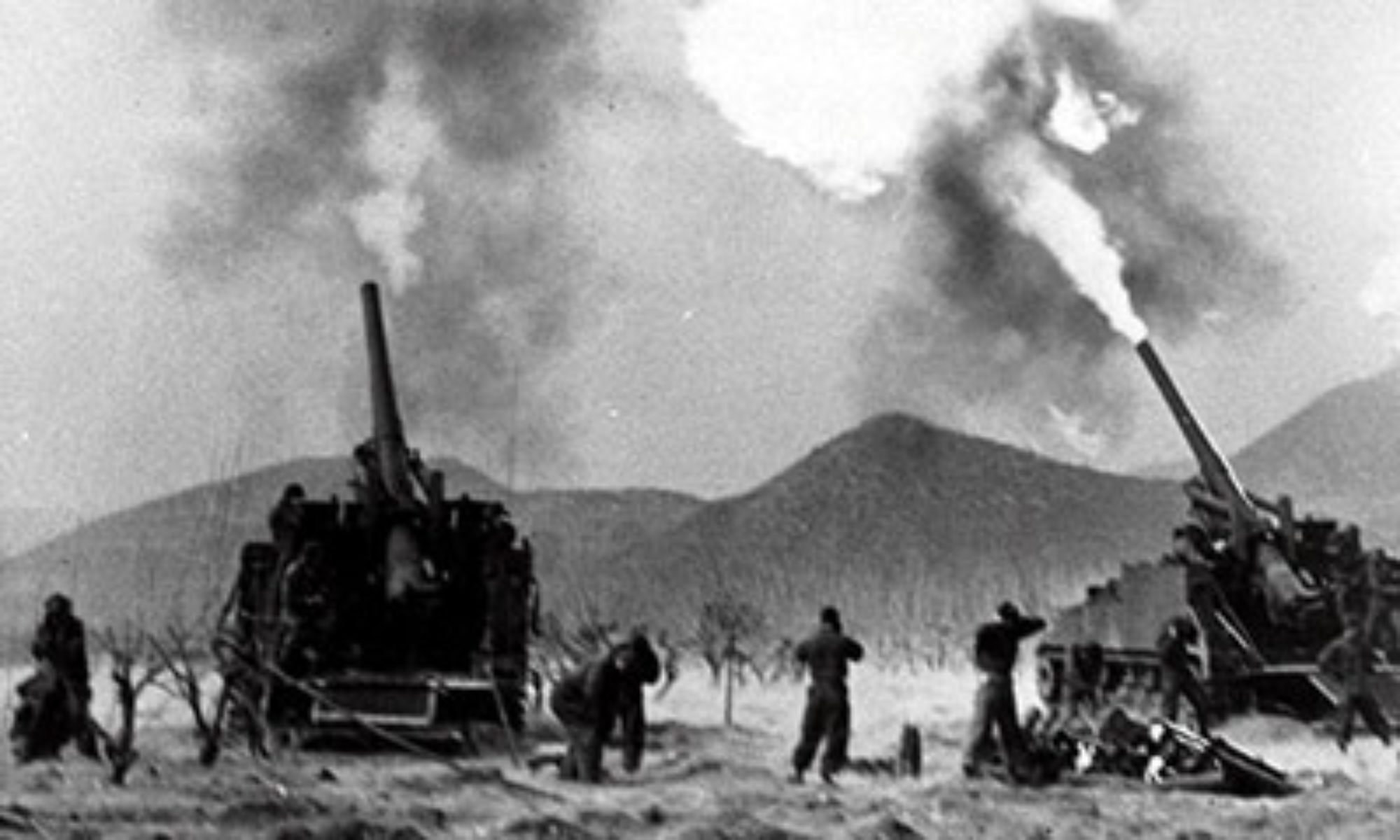
(Taken from Ecuadorian-Peruvian War – Wars of the 20th Century – Volume 3)
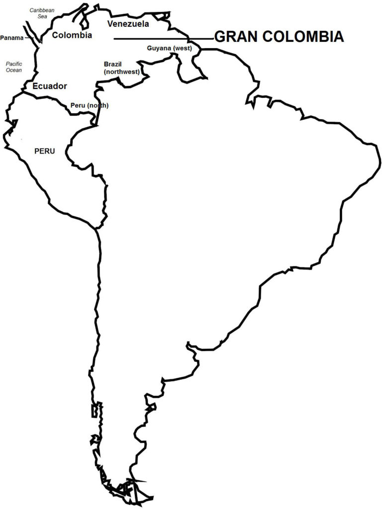
Background In 1941, war broke out between Ecuador and Peru for possession of the Amazonian regions of Maynas and Jaen, as well as Tumbez. The war has its origin dating from the last century, when both countries gained their independence from Spain, i.e. Ecuador as a province of Gran Colombia (in 1817), and Peru as a sovereign state (in 1821).
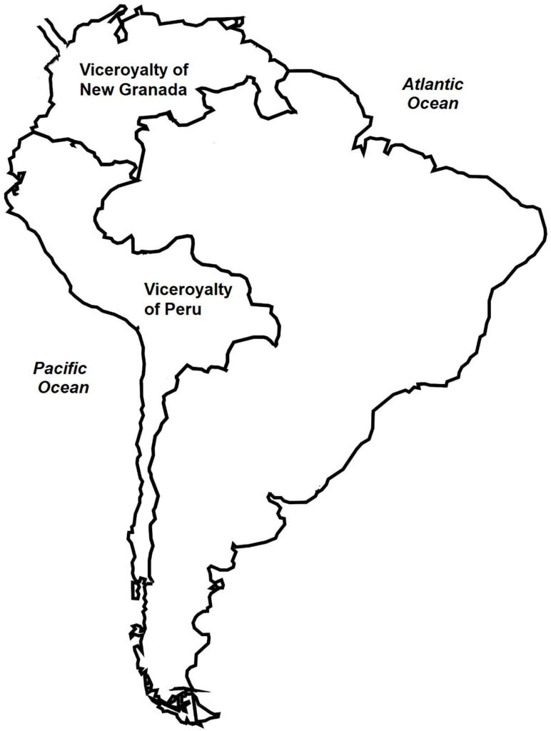
Gran Colombia and Peru, respectively, were formed from the Spanish territories of the Viceroyalty of New Granada and the Viceroyalty of Peru. These viceroyalties shared a border that was imprecisely defined in Maynas and Jaen, or had regions transferred between them, as in Tumbez. After gaining independence, Gran Colombia and Peru inherited these imprecise borders and the undelineated regions of Maynas, Jaen, and Tumbez.
Precisely as a result of their undefined border, Gran Colombia and Peru went to war in 1828. The war was inconclusive in the disputed regions, and the two countries agreed to maintain the territorial status quo. In 1830, Gran Colombia was dissolved and replaced by three new countries: Colombia, Venezuela, and Ecuador. The disputed lands now lay between Ecuador and Peru. The two countries met a number of times to resolve the issue and work out a common border. These negotiations failed, however, as the two sides held colonial-era documents that claimed ownership to the lands. Then in 1857, Ecuador tried to trade off a section of the disputed territories to pay off its foreign debt. Peru used military force to stop the transaction from taking place.
By the early 1900s, Peru had gained control of Tumbez and Jaen, and most of Maynas. In 1933, Peru had its claim strengthened after fighting a border war with Colombia. Negotiations after the war fixed the Colombia-Peru border. Colombia also recognized Peru’s sovereignty over Tumbez, Jaen, and Maynas.
In 1936, Peru and Ecuador signed the Lima Accord, where the two countries agreed to respect each other’s control of occupied lands inside the disputed territories. Within two years of the agreement, however, skirmishes were taking place in the region.